Beauty. Simplicity. Agriculture.
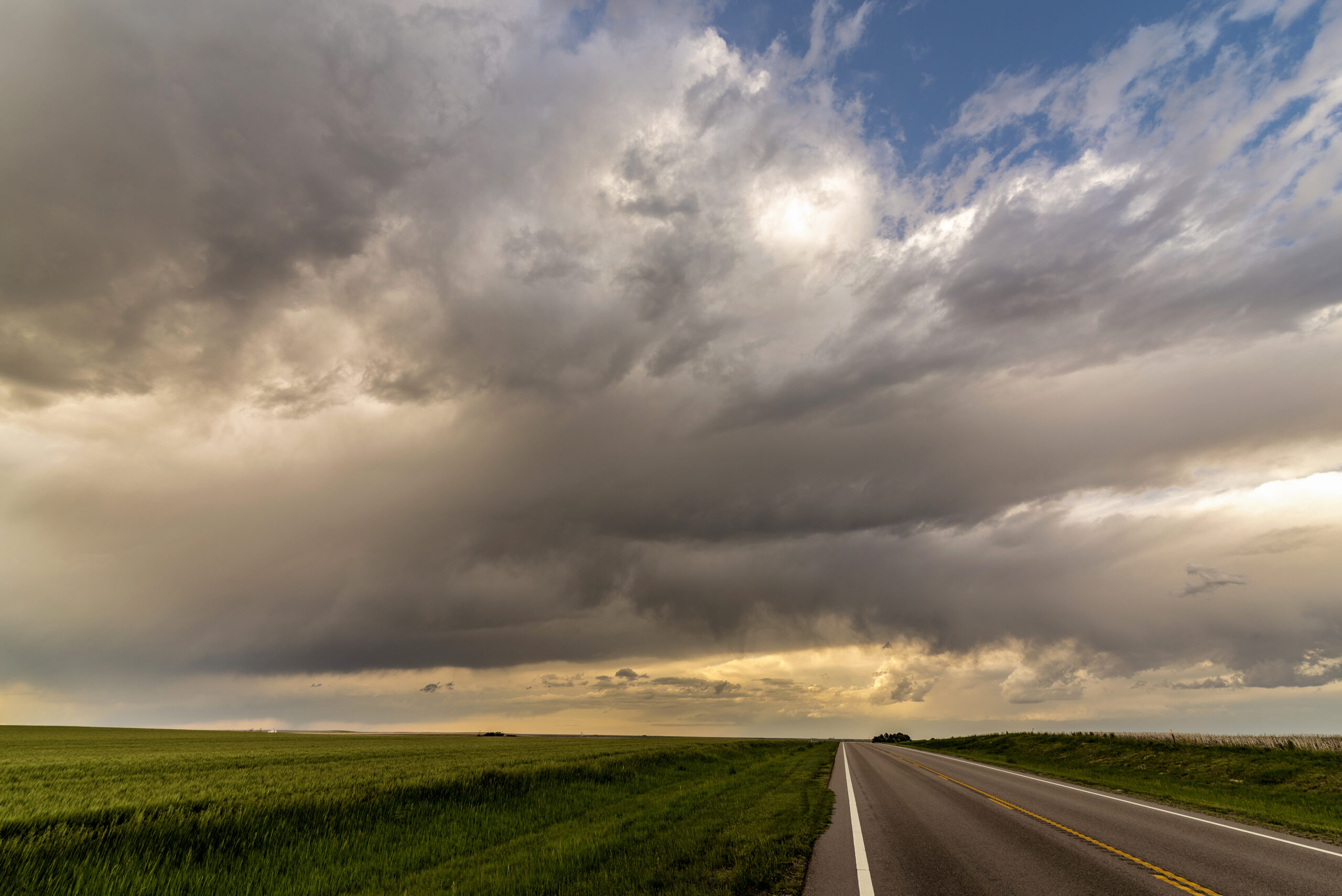
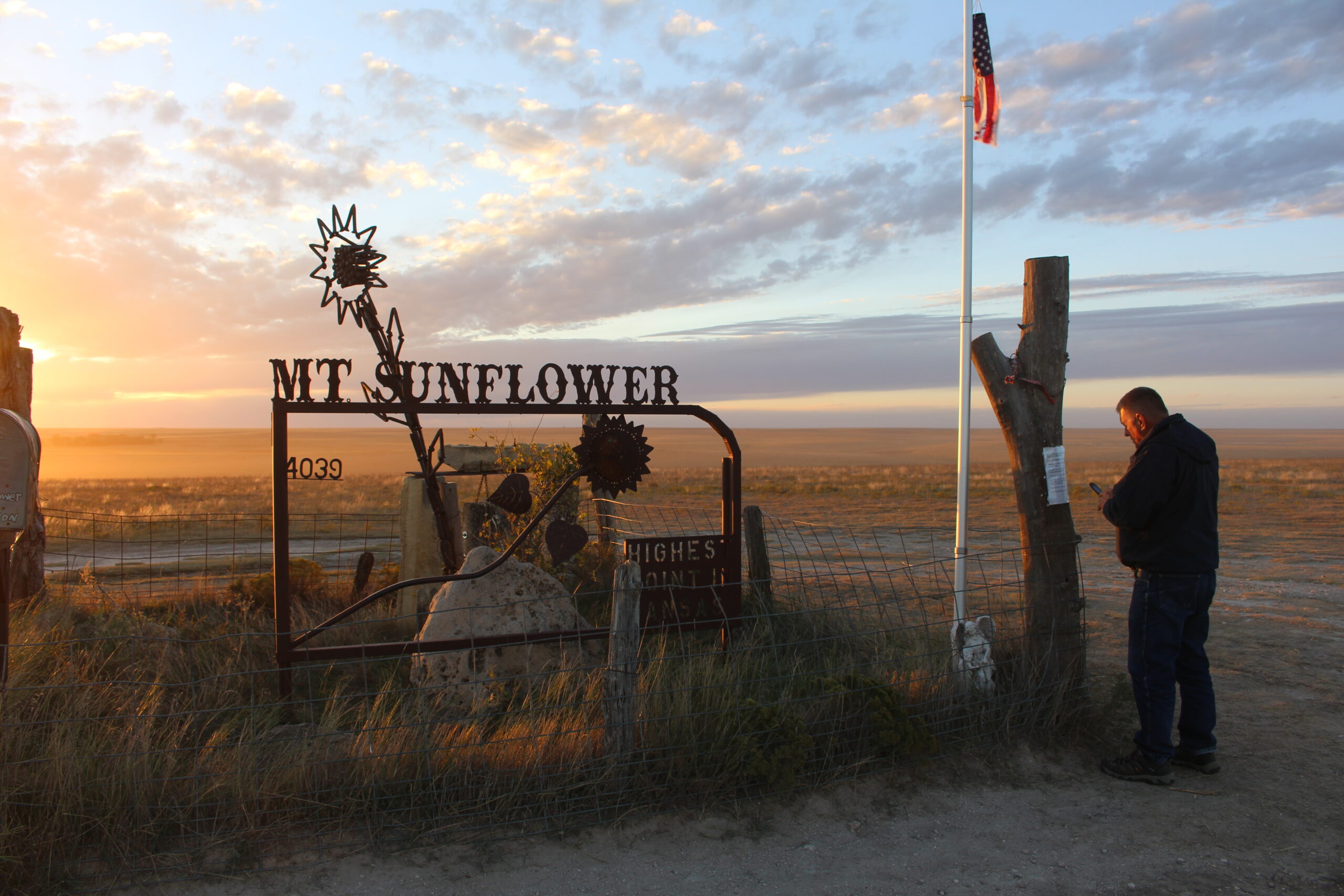
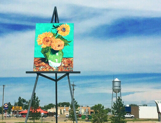
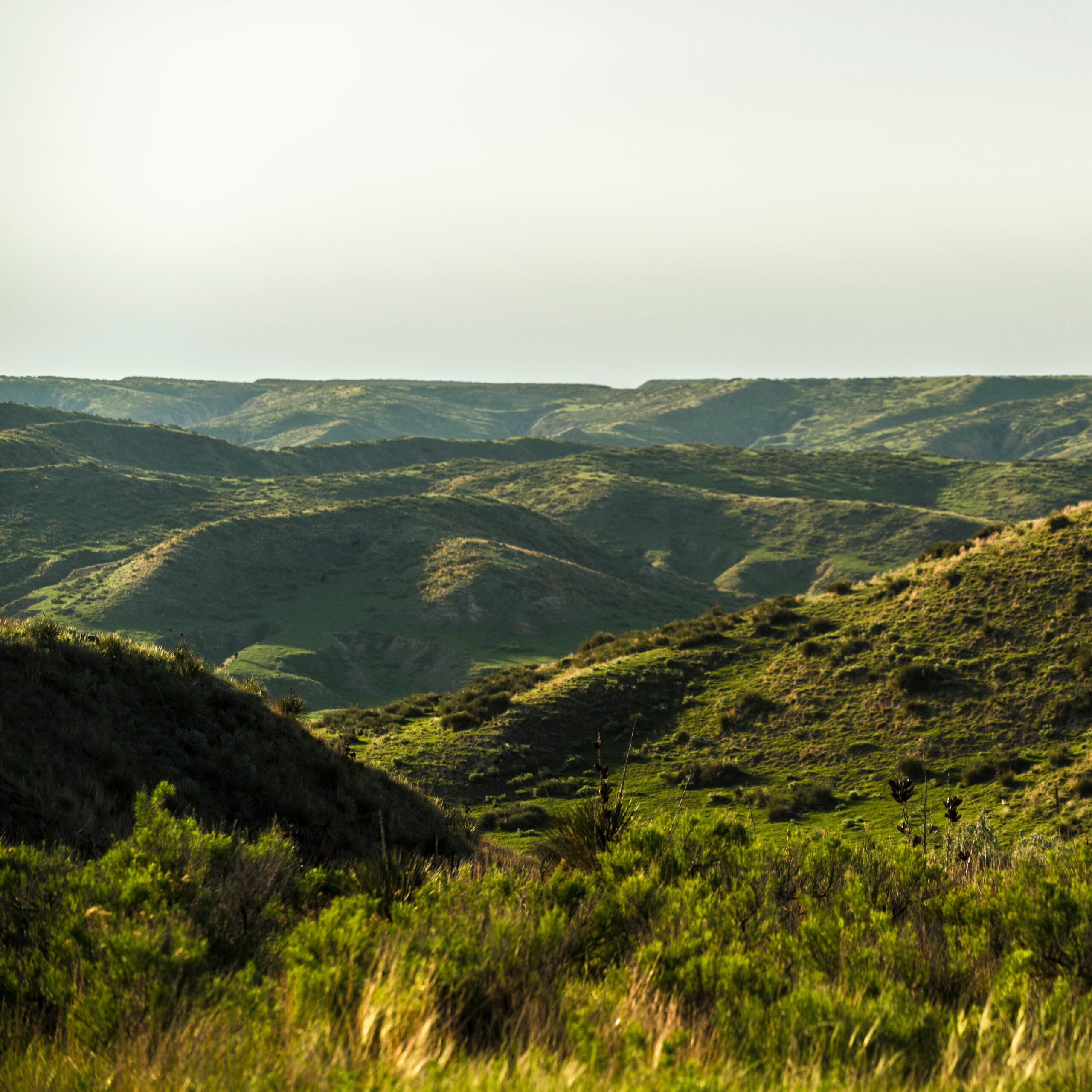
Travelers along the 88-mile-long Land and Sky Scenic Byway have the opportunity to experience the Wallace Branch of the Great Western Cattle Trail, explore the deep canyons and rugged landscape of the Arikaree Breaks, stand by a replica of the Van Gogh sunflower painting on an 80 ft. easel, and scale the highest point in Kansas at Mount Sunflower while watching the seasons of agriculture under the biggest skies you’ve ever seen..
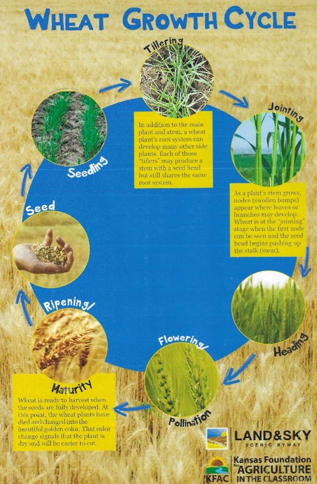
The byway is the only one in the state that focuses on agriculture and features thousands of acres of rotating crops, livestock, and wildlife along the route. Kiosks and Interpretative Signage tell the story of agriculture and show the life cycle of crops including wheat, corn, sorghum or milo, soybeans, and sunflowers.
Where beautiful landscape meets agriculture
The Land and Sky Scenic Byway is the only one in Kansas that focuses on agriculture and features thousands of acres of rotating crops, livestock, and wildlife along the route. Kiosks and Interpretative Signage tell the story of agriculture and show the life cycle of crops including wheat, corn, sorghum/milo, pinto beans, soybeans, and sunflowers.
LET’S VISIT!
The Three Countys That Make Up The Byway
The byway starts in the south in Wallace County, then north to Sherman County, then north into Cheyenne County and ends at the Nebraska State Line. Click the links below to see great things to do along the way.
ROUTE DESCRIPTION
Distance: 88 miles
Traveling south to north: The route begins at the junction of U.S. Highway 40 and Kansas Highway 27. Traveling north on Kansas Highway 27 the byway concludes at the Kansas/Nebraska state line.
Traveling north to south: The route begins at the Kansas/Nebraska near Haigler, NE. Traveling south on Kansas Highway 27 the byway concludes at the intersection of Kansas Highway 27 and US Highway 40 in Sharon Springs, KS.
From I-70 in Goodland:
North – Travel North on Kansas Highway 27 to Wheeler, turn west on Kansas Highway 27/US Highway 36, continue through St. Francis, and turn north on Kansas Highway 27 to the Kansas/Nebraska state line.
South -Travel South on Kansas Highway 27 to US Highway 40 in Sharon Springs.
Byway Map
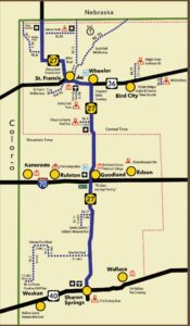
Click to enlarge
The agriculture you will see.
Agriculture
Wheat
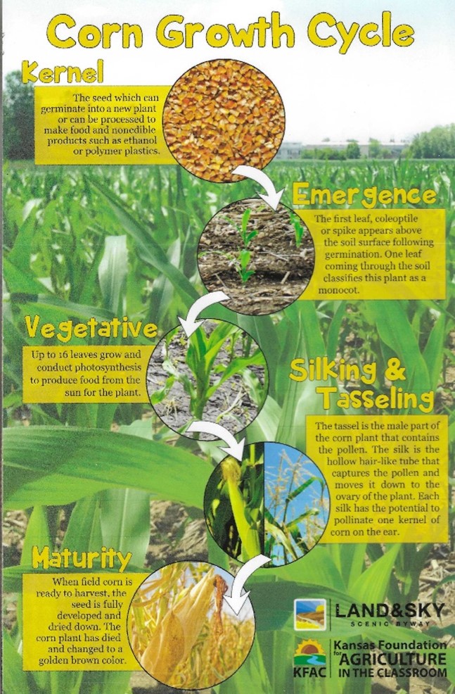
Corn
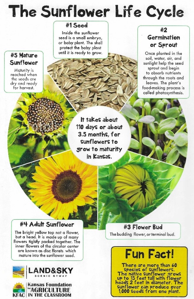
Sunflowers
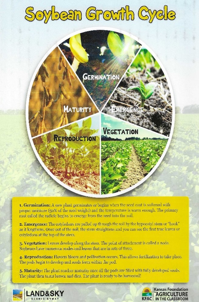
Soybeans
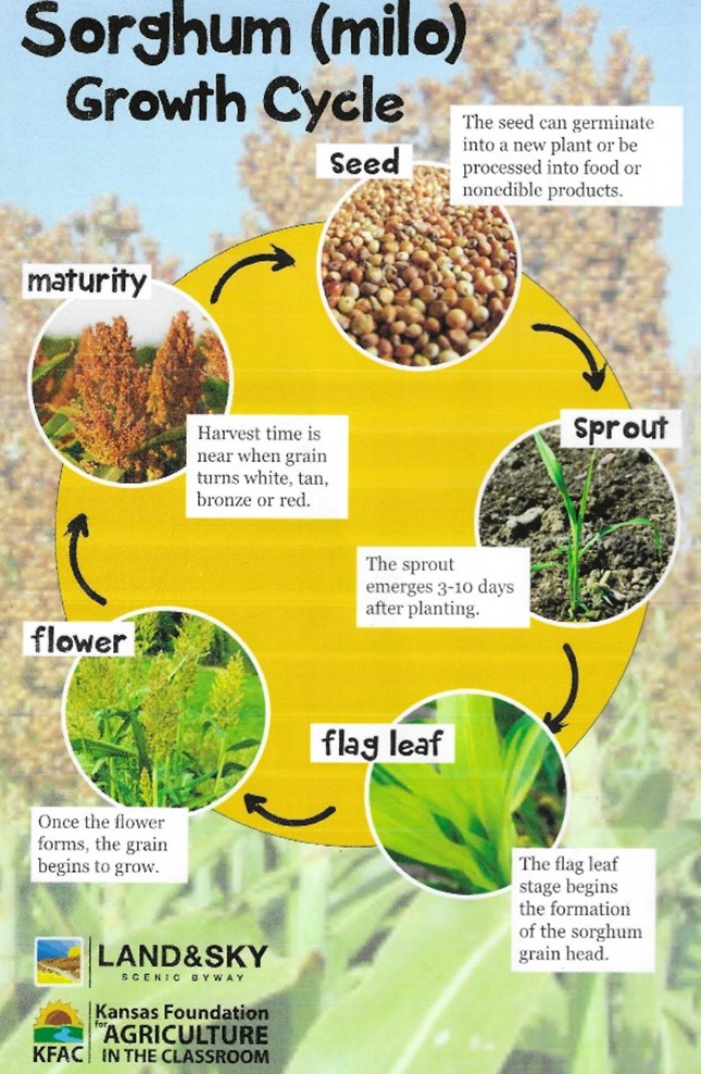
Sorghum (Milo)
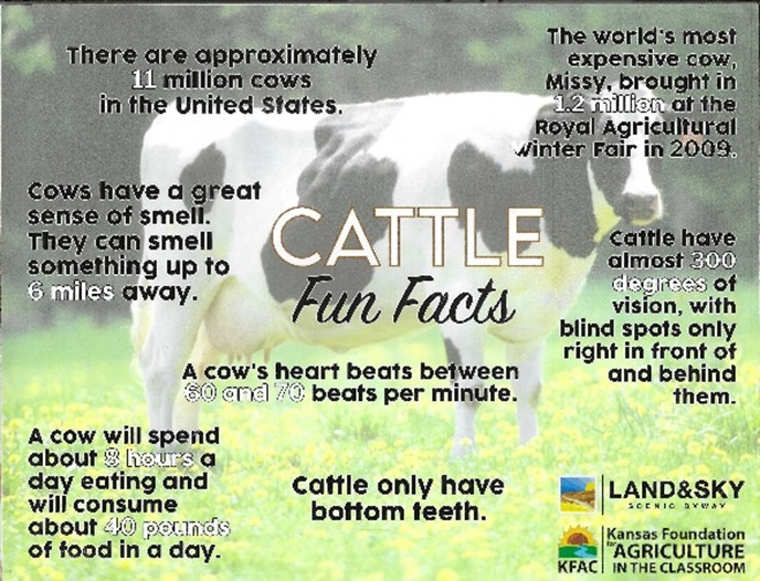
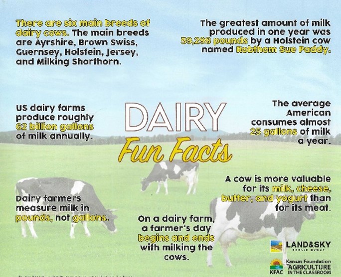
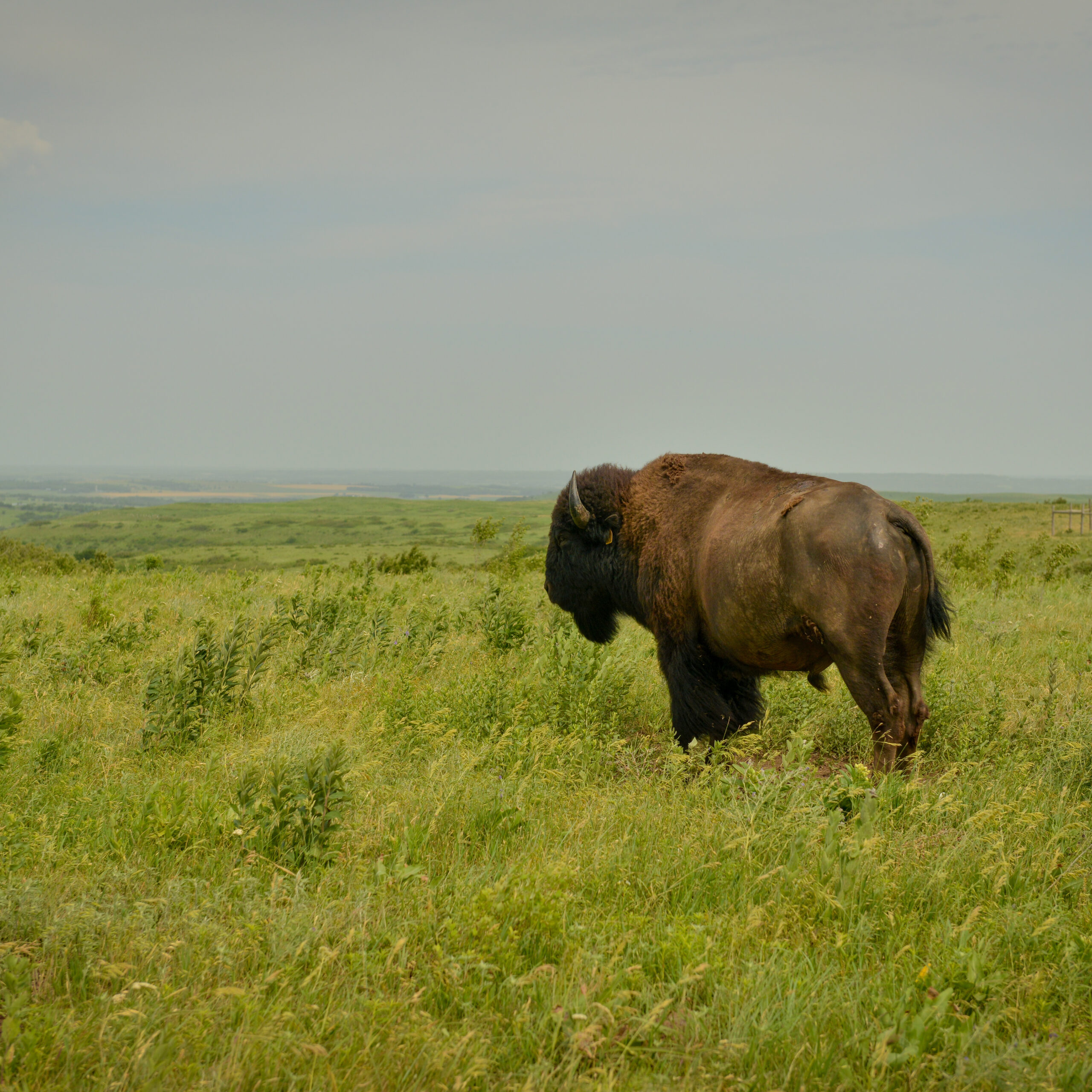
Cattle
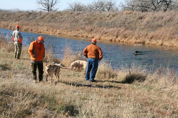
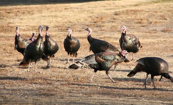
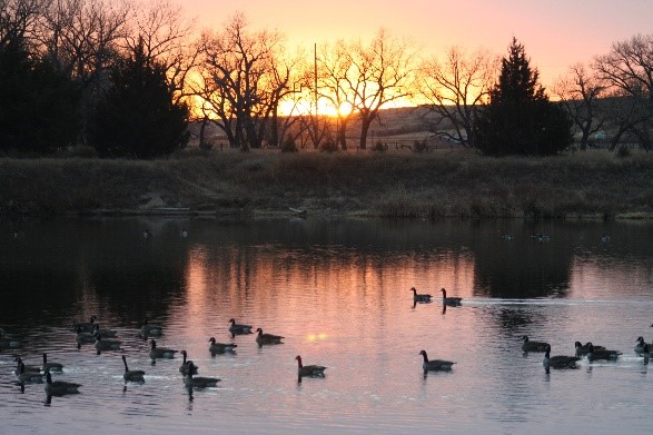
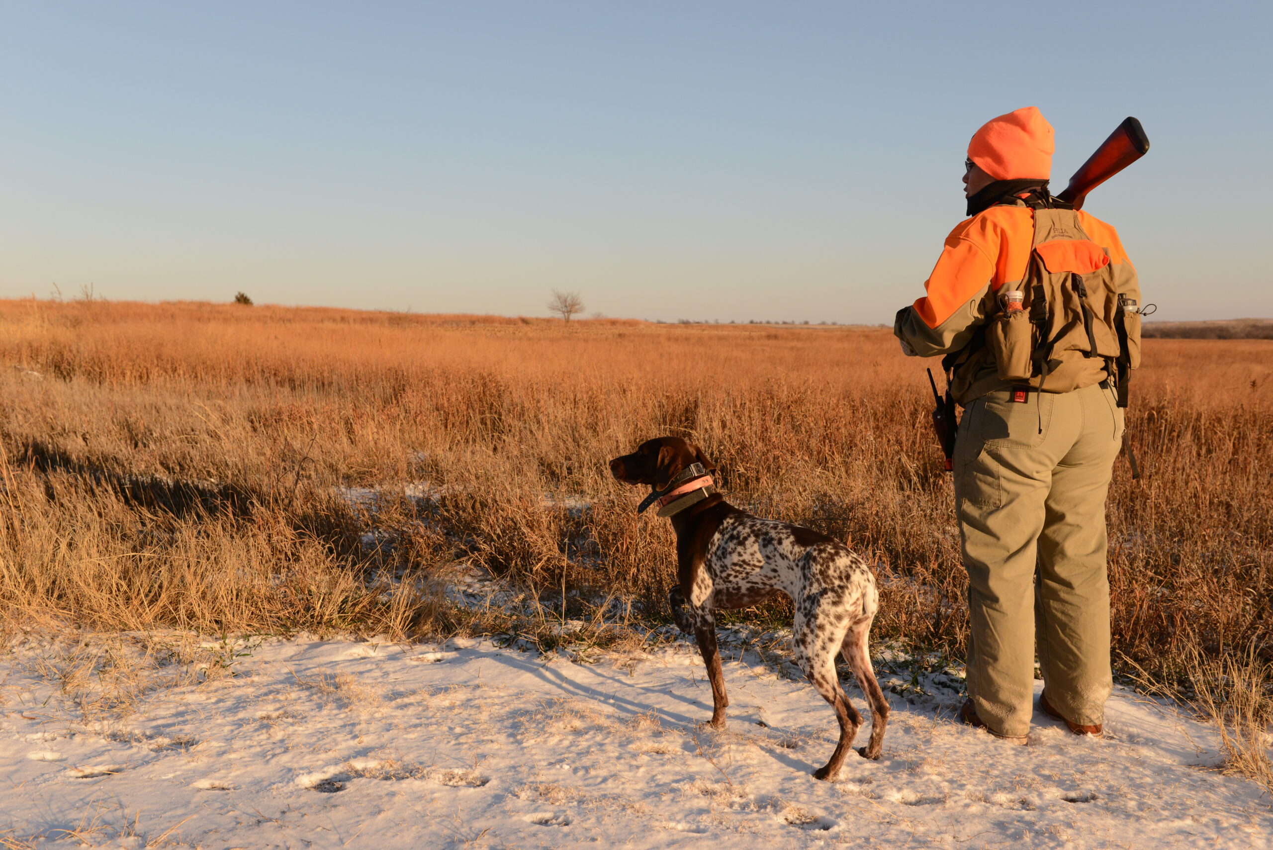
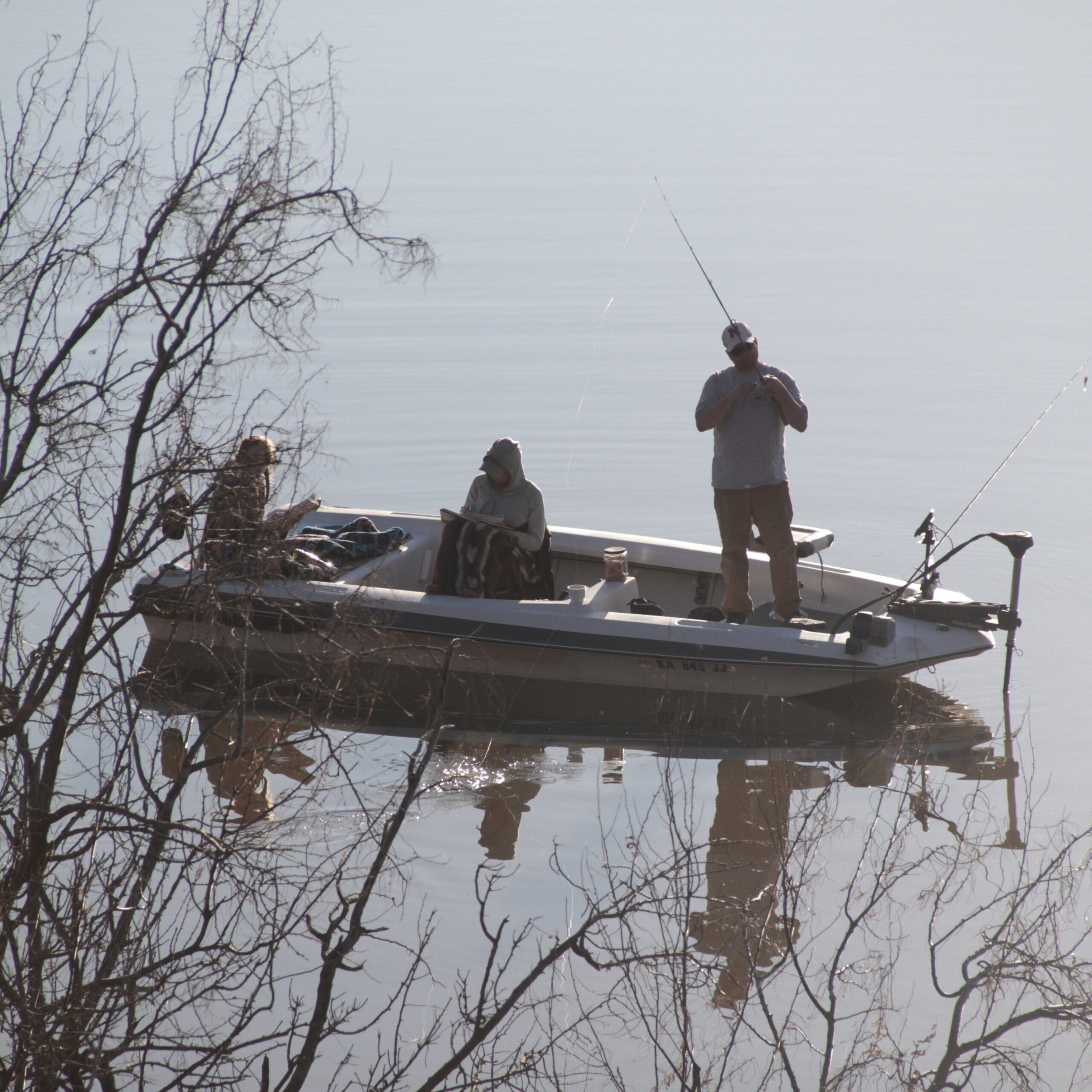
Wildlife
Opportunities for those liking to hunt and fish are available in Wildlife and Walk-In Hunting Areas. Several small lakes in the area are stocked with fish during the year.
Come spend the day with us!
There is so much to see and do. We can’t wait to see you soon.

Visit our Neighbors
Northwest Kansas has many great things to offer!